GLORY DAYS

GLORY DAYS
2004 Mainship 400 Trawler

Monday, November 28, 2011

ENDINGS AND BEGINNINGS

DAY 153, FRI. NOV. 11, 2011
AM FOG, COOL  PM CLEAR, SUNNY
DEP. AL.R. CUTOFF 07:30  ARR. MM.00.0 2:OO, ARR. EASTERN SHORE MARINA, FAIRHOPE, AL 4:20
D. 67.8 sm / 2883.6

Today marks the end of many things and the beginning of many new adventures. When we left the Coffeeville Lock yesterday we saw the end of the fresh water portion of our journey and the beginning of the familiar salt water. We have completed our journey through the western rivers including the Illinois WW, the Mighty Mississippi R. the Ohio R., the Cumberland R., the Tennessee R., the Tennessee-Tombigbee WW, and the Lower Black Warrior –Tombigbee WW, and the Mobile River. It is the end of river currents and the beginning of tides and tidal currents.   We crossed the 00.0 mile marker at approximately 2 PM this afternoon, entered the very commercial Mobile R. and proceeded south through Mobile and into the ship channel in Mobile Bay.   At day mark #72 we change course to due east (90*) for one mile, then change course to 125* for the 10 mile crossing of Mobile Bay to our destination of Eastern Shore Marina in the town of Fairhope, AL.   When we left the AL R. cutoff this morning, the temps were in the low 40’s and there was the usual early morning fog. We were up at 05:30, prepared to leave by 06:00, but were unable to see the entrance to the river and had to wait until 07:30 to leave.   So much for an early start. Well, at least we won’t be held up by any locks.   Surprise!   We were held up by a bridge. The RR bridge at mm 14 was replaced 2 weeks ago and closed the BWTB WW for 2 days. Today they were doing some testing, so after cruising faster than we usually do to make our destination before dark, we get stuck for 75 minutes along with 8 other boats.   At 3:45 we pulled up to the fuel dock, topped off the tanks and moved to our assigned slip for the night. WHAT AN ADVENTURE, SO FAR!  AMEN.


THE BEGINNINGS OF CIVILIZATION

MORE CIVILIZATION

UNCIVILIZATION

PROGRESS


THE OLD REMOVED BRIDGE

MOBILE, AL.

THE REPLACEMENT BRIDGE SPAN

ZAKIM BRIDGE????

GETTING CLOSER TO MOBILE

VERY BUSY WORKING HARBOR

IN THE SHIP CHANNEL, MOBILE BAY
 

UH! OH! ULN!! (UNIDENTIFIED LOUD NOISE)

DAY 152, THURS. NOV. 10, 2011
AM CLEAR, COOL PM CLEAR, SUNNY
DEP. BOBBIES FISH CAMP 06:45 ARR. ALABAMA R. CUTOFF (mm 52.8) 2:15
D. 56.1 sm / 2815.8
We left Bobbies at 06:45 for the Coffeeville Lock, our LAST LOCK of the trip.Well, there is one more just south of Norfolk, VA but that doesn’t count as it is only a drop of a few feet.At about 9AM we hear this very loud noise and the volt meter drops to 10 volts.It lasts for about 3 minutes then stops.About ½ hr. later it happens again.Unfortunately, I can’t identify it, but since the oil pressure and coolant temp is good, I keep on going.The other reason to keep going is there is absolutely no place to stop.We are cruising down a river and you either keep going or beach the boat.At 2:15 we pull into our planned anchorage for the night, the Alabama R. Cutoff at mm52.8.It is about 75’ wide, 100 yds. long, and 8’ deep.You have to pull in, turn the boat 180 degrees then drop the anchor.This is where I discover what the noise was.NO BOW THRUSTER!!!Fortunately, Frank (Once Around) and Frank (Irony) are there in their dinghies and they pretend to be tug boats and help me turn the boat and set the hook.The rest of the night was good, except for the cold.The outside temps dropped to below freezing and there was frost on the deck in the morning.The inside temp got down to 50 and there was frost on my behind.
THIS IS A SMALL TOW
 

WHAT ENGINEER DESIGNED THIS RIVER?

UNDER WAY IN THE BLACK WARRIOR TOMBIGBE WW
 
GPS/CHARTPLOTTER SHOWING RIVER'S COURSE

LOADING BARGES

SANDY BEACHES ON INSIDES OF TURNS

FLOOD EROSION

BOBBIES FISH CAMP

DAY 151, WED NOV. 9, 2011
AM/PM CLOUDY, SHOWERS, COOL
DEP. BASHI CREEK 08:00  ARR. BOBBIE’S FISH CAMP (mm117) 11:00
D. 27 sm / 2759.7

After a very comfortable night at Bashi Creek, we left about 8AM we are headed to Bobby’s Fish Camp only 27 miles south.  The Black Warrior Tombigbee WW (BWTB) gets really beautiful here.  After some boring scenery this part has many turns and switchbacks and many offer very scenic views, especially Davis Bluffs at mm141.1.  The many turns also have a downside, you can’t see the tows coming!  The last thing you want to do is to come around a bend and find yourself in the path of a tow that is 3 barges wide and 6 deep.  This is where AIS (automatic info system) comes in, and I am glad I invested in it.  Every tow has a transponder that transmits its name, direction, speed, and most importantly location and direction of travel.  This info is listed on my AIS receiver and is also graphically displayed on the chart plotter.  When we are within a mile or 2 of a tow we call on the radio and ask for instructions on meeting or overtaking (1 whistle or 2?).  It makes the journey much safer, and keeps the stress level down.  I must add, that every tow captain has been very friendly and helpful.  When you think about it, they don’t want an accident any more than you do, and I know from personal experience that they get stressed out when ignorant boaters do stupid things.  They do a fantastic job of guiding these tows, sometimes over 600’ long and 150’ wide, around these turns, but cannot stop them or change direction very quickly.  Our responsibility is to stay out of their way.  We arrived a Bobbie’s Fish Camp at 11:00 AM.  It is owned by Laura Jane, bless her heart, and is located in Silas AL.  She inherited it from her father the late Bobbie who passed away 2 years ago.  This place is a rare old relic with lots of emphasis on the fish camp.  The marina seems like an afterthought.  It is “self service.”  You pull up, tie up, hook up to the newly installed electric, and then walk up the hill to pay.  The problem is Laura Jane charges $1.50 per foot which is 50% more than every other marina.  She gets it because she is the only place to stay in this stretch of the river.  Her restaurant is only open Thurs. thru Sat, but because there are 6 of us she will open for us tonight.  The mistake we made here is not asking the price.  We have fried catfish with French fries and coleslaw, and fried pickles for an appetizer and the check is $50 with the tip.  BTW, if you haven’t had fried pickles, you don’t know what you are missing.
THE UBIQUITOUS BARGE

CHARTPLOTTER, NOTE BLACK SYMBOL, (GLORY DAYS), & GREY TRIANGLE TO R & L,  (TOW SYMBOLS)

DAVIS BLUFF

SCENIC RIVER VIEW


BOBBIES COTTAGES

GLORY DAYS, KISMET, AND CAPT. JOE

COTTAGE CLOSE UP

80 MILES TO A BEAUTIFUL ANCHORAGE

DAY 150, TUES. NOV. 8, 2011
AM COOL & CLEAR  NO FOG!!   PM CLEAR, SUNNY 77*
DEP. DEMOPOLIS (mm216.9) 06:15  ARR. BASHI CREEK (mm145.0) 2:30
D. 81.9 sm / 2732.7
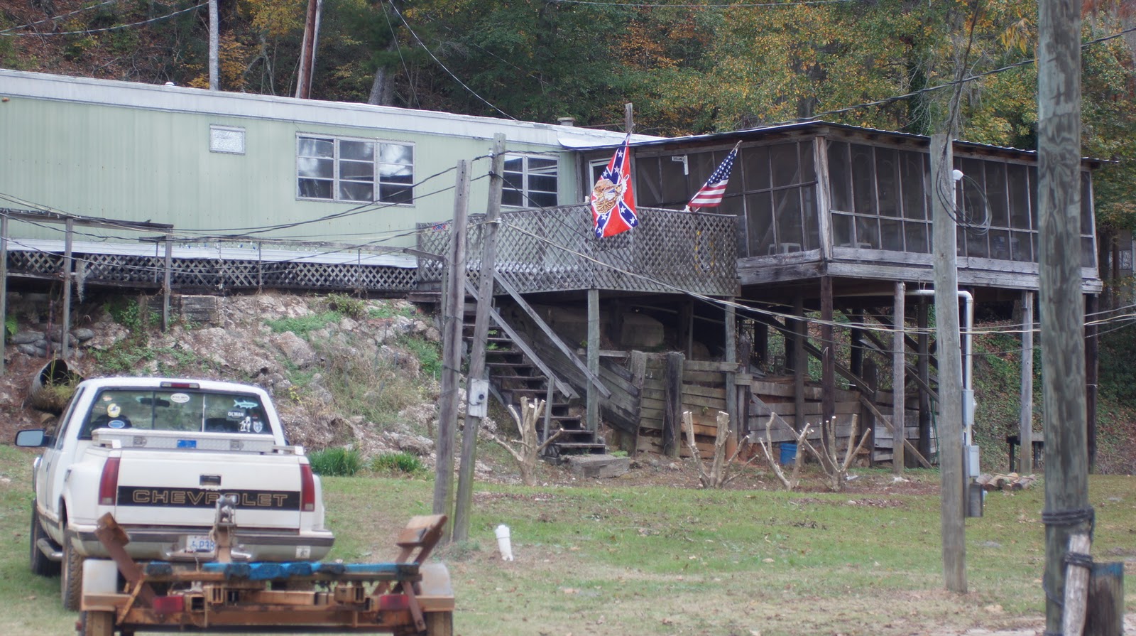
Today is a long day.  We have to get to Bashi Creek, the first anchorage down river from Demopolis, 82 miles distant.  At 10 mph, which is faster than we usually cruise it will take 8 hours, plus the time to get through the Demopolis Lock.  The “plan” is to start at first light.  There will be 8 boats leaving, and the lockmasters like to get as many together to lock down as possible.  We call the lock at 5:30 to see how soon the lock will be ready, so we can leave together,  (in an orderly fashion).  Unfortunately, today there is a tow in the lock and we can’t get in until 6:30.  We see on the AIS, there is also another tow on the way to the lock about 5 miles north, so we have to get there before him or wait another hour.  We were all into the lock by 06:40 and departed the lock at 07:15.  Fortunately, there was no fog this morning, so we were on our way, or so we thought.  By 10AM we encountered 5 tows, 4 meeting and 1 overtaking.  The thing that slowed us down was that 2 of the tows were coming around corners, and we had to slow way down, even stop, so we didn’t meet them on a turn.  These tows are so big that they can take up a whole bend just crabbing around it, and we need to be out of the way.  The other issue we have is “anchorage anxiety.”  It comes from having little or misleading information about an anchorage.  In the case of where we plan to anchor out tonight, we have had conflicting reports.  People who know the anchorage well, say there is no problem.  However, I spoke with someone who was there last week and they said we couldn’t get into it because a tree was submerged in the entrance.  If Bashi Cr. was closed we would have to travel another 3 hours and risk getting to Bobbies Fish Camp in the dark.  About 1 PM I was able to call Ed from KayDeeAnna.  He was in there 2 days ago and gave me the real story.  Yes, there is a tree in the entrance, but “keep the tree to starboard, and the dock to port, and you will not have a problem.”  This anchorage really is a creek.  It is about 75’ wide, 300’ long, and 5’-6’deep, with trees and dense undergrowth on the banks.  We followed the directions in and rafted with Kismet, bow to stern, with each of our bow anchors down.  It turned out to be a very secure and snug place to be.
APPROACHING THE LOCK

DAM AT COFFEEVILLE LOCK
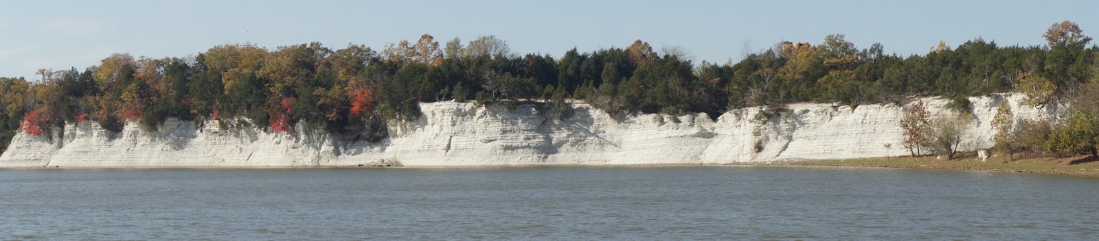
SCENIC BANKS

NOTE THE TOW APPROACHING

TOW MEETING

GPS SHOWING THE RIVER'S COURSE

BASHI CREEK ANCHORAGE LOOKING EAST

BASHI CREEK ANCHORAGE LOOKING WEST TOWARDS RIVER

HAPPY BIRTHDAY PAT

DAY 149, MON. NOV 7, 2011
AT DEMOPOLIS, AL  MUNICIPAL MARINA
Today is a layover day at Demopolis, and Pat’s birthday.  Since I haven’t had any opportunity to get a present, I have to think of something to do for Pat.  I have the idea of getting a birthday cake at Wal-Mart, and inviting all the Loopers in the marina to a surprise party at the boater’s lounge.  Fortunately, when we registered, Pat asked for a slip convenient to the laundry.  Also, fortunately, the laundry also housed the heads, showers, and a very nice lounge, all brand new, and it was right next to our boat.  I ordered the cake and made arrangements to pick it up that afternoon.  I also went around to all the Loopers and told them my plans.  They  not only all promised to attend, but they also helped out.  They brought coffee, cups, silverware, etc.  Later that afternoon I called WM to make sure the cake was ready.  They did not have the order!  I asked to speak with the mgr. and got it all straightened out.  I want a birthday cake that says “HAPPY BIRTHDAY PAT.”  At 4PM I borrow the loaner car and drive to WM to pick up the cake.  The woman at the counter tells me there is no cake that says happy birthday Pat, and asks my name.  She looks around and finds my cake, except is says “HAPPY BIRTHDAY CAT”.  The problem is, I speak English, but apparently not “southern English.”  She fixed the cake; I brought it back and left it with Mary & Bill on Harbor Reach.  I told everyone to be at the lounge by 7:30 and I would bring Pat there after dinner at the marina restaurant.  It was GREAT!.. As we approached the lounge, Pat saw all the people there and thought it was just a meeting to discuss the next day’s cruise planning.  When we walked in they all shouted “HAPPY BIRTHDAY” and she was surprised speechless.  After a rousing rendition of the birthday song, we all had cake and coffee and partied til the late hour of 9 o’clock.
SURPRISE!


BILL(Harbor Reach), DEAN & BETH(Kismet), BILL(Seabiscuit), KEN(20 Bucks)

KEN(20 Bucks), RUSTY(C-Bay), PAT(20 Bucks)

PAM(Seabiscuit), MARY(Harbor Reach)

PAT, CARRIE (ONCE AROUND)

OUR ONLY WAY TO GET AROUND

DESSERT!
no

The White Cliffs of Epes

DAY 148 SUN. NOV. 6, 2011
DEP. SUMPTER ANCHORAGE 07:10  ARR DEMOPOLIS AL mm216 1:30
AM COOL, CLEAR, PM SUNNY COOL
D. 52.9 sm / 2650.8
Since we were on a anchor overnight we had no heat in the boat and the cabin was 54 degrees when we woke up.  Needless to say, we started the generator and turned up the heat.  We pulled the anchor at 7:10 and headed for the Gainsville/Heflin Lock at mm 266.  By now we are old pros at locking thru so there was no problem with this lock and we were thru at 08:00.  We are nearing the end of the TENNESSEE-TOMBIGBEE WW and the scenery here is spectacular.  At Demopolis, we will begin the BLACK WARRIOR-TOMBIGBEE WW which is even more scenic, and remote.  At mm 248.8 we pass the White Cliffs of Epes.  Here's a link to the video that Beth took on Kismet.  That's Glory Days in the lead. 
http://www.youtube.com/watch?v=kryaywF1lFA


KISMET


AT SUMPTER LANDING REC AREA

DAT 147 SAT. NOV.5, 2011
AM FOG  PM SUNNY, WARM
DEP. PIRATES MARINA COVE mm (307.4)  07:40  ARR. SUMPTER LANDING REC. AREA mm (269.8) 12:50
D. 37.2sm / 2597.9
We waited for the early am fog to clear and entered the Bevill Lock at 08:00.  Unfortunately, as often times happens, the down river side of the lock was totally fogged in.  Since there is no place to tie up or anchor we had no choice but to proceed slowly until the fog cleared about 09:15.  The rest of the day was beautiful.  We anchored in a beautiful spot in the Sumpter Area State Park, took the dinghy ashore with Beth & Dean, and took a short walk through the woods.  The anchorage was very well protected from wind and current from all sides, and we enjoyed a peaceful quiet night at anchor.
GLORY DAYS AT SUMPTER LANDING

DEAN, PAT, BETH

WAITING FOE THE LOCK TO OPEN

SUMPTER LANDING ANCHORAGE
(PICTURE TAKEN FROM KISMET, SEABISCUIT PORT BOW GLORY DAYS STBD BOW)