GLORY DAYS

GLORY DAYS
2004 Mainship 400 Trawler

Wednesday, May 30, 2012

DISMAL SWAMP PART 2 / A DARING RESCUE AT SEA / MILE MARKER ZERO

DAY 309; MON. MAY 21, 2012
DEP. WELCOME CENTER (mm28) 08:08ARR. PORTSMOUTH, VA (mm 0) 1:15
D. 25.2 sm / 5018.8
The Dismal Swamp Canal, which connects the Elizabeth R. in VA and the Pasquotank R. in NC, is the oldest continually operating canal in the US. The surveyor of the canal was none other than George Washington, also one of the first investors, in 1764.  It was started in 1793 and completedin1804 and doesn’t appear to have changed any since then. (http://dismalswamp.net/).
We awoke to a foggy morning, but in this canal only 30’ visibility is necessary to see both banks.The southbound sailors departed at 07:00 as promised, and our group of 5 departed with S/V True Loev (the owner's last name, Loev) in the lead followed by S/V St. Louie Lady, then M/Vs Glory Days, Eos, and Something Special.  Between mm 28 and mm 21 we had to dodge a few deadheads, but nothing serious.  At 08:20 we crossed the border from NC into VA. Then, at 09:00, just north of mm 21 we saw the fallen tree. We could see the trunk on the eastern shore, and the upper branches with the leaves still on them on the western shore.True Loev was first to go and he got hung up, but was able to free himself and made it across.  St. Louie Lady was next and she got hung up and in an attempt to get free wound up against the western bank with her mast stuck high up in the tree branches.  Since Glory Days was next in line we had to either attempt to pull her off or spend the day waiting for help.  The decision was easy, and although the rescue wasn’t exactly daring, and not at sea, it does add a bit of excitement.  We pulled up at about a 45 degree angle to her stbd.  stern quarter, handed her a line from our bow, and backed up pulling her free from the tree, both on the bottom and on the top. The only damage she suffered was a broken anchor light.  When she became free she backed down and it was our turn to attempt the crossing.  We picked up enough speed to carry us across and shifted into neutral as the bow hit the branches.The momentum carried us over and the rest of the boats followed suit with no further problems.  AMEN! The rest of the trip was uneventful, except for one thing, at mm 18.8 we crossed the 5,000 mile mark on our journey. The sun came out and it was actually beautiful.  We made the Deep Creek Bridge and Lock in time for the 11:00 opening, and met the famous lockmaster Robert.  He is somewhat of a legend  on the Dismal Swamp.  He is very friendly, professional, and treats everyone like a long lost friend.  He has a huge collection of conch shells and uses them to landscape the area around his lock house.  As we departed he picked up a conch and blew us a farewell tune.  Some days are fun, but others are really fun.
The final event of the day occurred at 1:02PM.We crossed mm0.
07:20

AN EARLY MORNING START


NICE BOAT HOUSE

CANAL WATCH DOGS

TRUE LOEV STUCK ON THE TREE

BELIEVE IT OR NOT THE SIGN SAYS "SUPERINTENDANTS HOUSE"

THE VIEW FROM THE BRIDGE


BOB, LOCKMASTER AT DEEP CREEK LOCK

CHECK OUT THE CONCH SHELLS


THE DISMAL SWAMP PART 1.


DAY 308:  MON. MAY 21, 2012
DEP. ELIZABETH CITY 08:30   ARR. Dismal Swamp WELCOME CENTER (mm28)12:50
WX: SUNNY AM, CHANCE OF SHOWERS T-STORMS
D. 23.2sm / 4993.7
We awoke this morning to a pleasant surprise, SUNSHINE, and very little wind.  There has been a low pressure system stalled off the coast of NC and not only has it been cloudy, wet, and cool, the forecast for the next week is for mostly cloudy with a chance of showers and possible t-storms.  This morning was beautiful.  The Elizabeth City Docks are about 100 yards south of the US 158 highway bridge which has a 2’ clearance and they do not open between 7:00 & 9:00 AM unless there are boats waiting and then they only open at 7:30 & 8:30.  Eighteen miles up the Dismal Swamp Canal, the lock only opens at 8:00 and 11:00 in the morning, so we had to get thru the bridge at 08:30 to make the lock at 11:00.  So much for that.  It was an absolutely beautiful trip up the Pasquotank River to Turner’s Cut, and into the Dismal Swamp Canal.  The water was flat calm and the natural scenery was beautiful.  We even saw a Bald Eagle.  The river was about 100 yards wide and gradually narrowed as we went north.  Turner’s Cut was about 50 yards wide, but the really narrow part began with the Dismal Swamp Canal, about 20 yards wide.  Not only was it narrow, we had to pass several deadheads that were in the middle of the canal.  Needless to say, we cruised very slowly.  We got to the Welcome Center about 12:30 and good news, there were no boats tied up.  Glory Days was first, followed by Eos, a 47’ Selene, and Something Special.  We thought we had the whole place to ourselves until about 2:00 when 2 sailboats heading north joined us.  Since there is only room for 3 boats to tie up, the sailors had to raft up with us.  Around 4:00, 7 southbound sailboats arrived and they also rafted on.  The grand total was 12 boats and it is fortunate that the locks closed and no more boats would be coming because there would be no more room to tie on or pass between the boats and the shore.  Tomorrow the southbound boats will leave at 7:00 and we will leave at 07:30 in order to make the 11:00 lock opening at the other end of the canal.  The bad news is the southbound boats told us of a tree that is laying across the canal and the only way to get around it is to pass over its upper branches.


ELIZABETH RIVER

BALD EAGLE

BEAUTIFUL MORNING
 
PASSING IN THE CANAL
A 12 BOAT RAFT UP
WELCOME CENTER


ANOTHER BAD FORECAST

DAY 307: SUN. MAY 20, 2012
DEP. ALLIGATOR R. 07:33  ARR. ELIZABETH CITY, NC (mm 50.7) 12:13
NORTH WIND 25K SEAS 6’
We check the weather every day before we make the decision to depart. This is the second time this week NOAA has given us bad info. The forecast was for north winds 11k to 14k and waves “around 2’.  Ten minutes into Albemarle Sound and the winds picked up to 25k and the waves to 6’. Albemarle Sound is where at mm 80.1 the ICW splits. Route 1 goes to Norfolk via Great Bridge and route 2, our chosen route, goes to Norfolk through Elizabeth City and the famous Dismal Swamp. While under way in these conditions I checked NOAA weather radio for the latest forecast, and sure enough, they reported conditions as 15k winds and waves around 2’. It wasn’t as bad as Fri. in the Neuse R., but it was bad enough. Fortunately we only had to endure it for 10 miles, about an hour and a half. As soon as we got to the lee of the north side of the sound the waves diminished and we made our way up the Pasquotank River to Elizabeth City ( http://www.discoverelizabethcity.com). Elizabeth City bills itself as “The Harbor of Hospitality,” and that it is. They offer FREE docks, a wine and cheese happy hour every day, and the tradition of a free rose to every lady boater. Unfortunately, we are there on Sunday. and that’s the only day they are shut down. They also have an excellent museum, but that’s closed too. The city itself is typical of most downtowns. It is struggling to re invent itself by promoting tourism and it is ideally located to appeal to boaters wishing to take the Dismal Swamp route.

WELCOME TO "HARBOR OF HOSPITALITY"

THIS BARGE LOOKED LIKE IT WAS GOING TO RAM US JUST BEFORE IT TURNED

THE FREE DOCK


MAIN STREET ON SUNDAY

THE ALBEMARLE MUSEUM

PUNGO TO ALLIGATOR

DAY 306: SAT. MAY 19, 2012
DEP. BELHAVEN, NC 07:26 ARR. ALLIGATOR R. MARINA (mm84.2) 12:26
WX FORECAST: N WIND 14-18K, CHANCE OF SHOWERS, PM T-STORMS
D. 50.2sm / 4933
We seem to be in a weather pattern where the forecast is the same every day. A chance of rain and t-storms. Today is another windy day, but not as bad as yesterday, and most of our trip will be in more protected waters. Belhaven is on the Pungo River which we follow for 10 miles before we enter the Alligator River Pungo Canal which is narrow and flat calm for the next 21 miles. The Canal connects to the Alligator R. which is much wider, but we only encounter 2’-3’ waves here and only have to cruise for another 20 miles. The marina is a Shell gas station a highway in the front, and a river in the back in Columbia NC, but miles from the town.  It has a small convenience/marine store and a small restaurant. It sells fuel and has about 30 slips. We fueled up here as the price is good and made it into our slip without a problem in spite of the still 18K winds.
GLORY DAYS & SOMETHING SPECIAL
ALLIGATOR RIVER MARINA

ALLIGATOR/PUNGO CANAL

DEADHEADS ALONG THE SHORE

LOG JAM IN A MUDDY RIVER

CAN YOU FIND THE BALG EAGLE?

BAD NEUSE (PUN INTENDED)

Day 305; MAY 18, 2012
DEP. ORIENTAL, NC (mm 182) 07:43  ARR. BELHAVEN NC (mm135)12:26
WX FORECAST:  NE WIND 15-18K, CHANCE OF SHOWERS, PM T-STORMS
D. 49.9 / 4882.8
The forecast called for North winds of 15k to 18k.  How bad can that be?   PRETTY BAD!  We entered the Neuse River about 08:15 and the current was ebbing, which put it in direct opposition to the wind.  This makes for a lot of steep waves with a very short space between them (wave period).  The wave height was about 4’ directly on the bow.  As we proceeded downriver the wind picked up considerably (28mph was the report) and the waves 6; to 8’. We were never in any danger, but it was very uncomfortable and we had to endure it for about 10 miles before we got into the lee of the land and the waves calmed down to about 4’. When we got to Dowry Creek Marina the wind was blowing hard and made docking difficult.  Regrettably we didnt take any pictures today as Pat was too busy praying and I was to busy driving.


Tuesday, May 29, 2012

ORIENTAL, NC

DAY 304 THURS, MAY 17, 2012
DEP. BEAUFORT, NC 08:50 ARR. RIVER DUNES, ORIENTAL, NC 1:43
AM CHANCE OF T-STORMS AND RAIN
D. 35.4sm / 4837.9
Cruised from Beaufort, NC to River Dunes with the threat of rain and t-storms.  We could hear distant thunder all around us and hoped we wouldn’t run into it. Then at 11:30, in the Neuse River we ran into very heavy rain. It was the kind of rain that reduces visibility to 50 yards. We could see the storm on the radar, and we were right in the middle of it. We slowed down to idle speed as it looked like the rain was going in our direction and would pass us by, but it seemed to be stalled right over us. At about noon visibility picked up to about a mile and we proceeded to River Dunes. We saw the ads for River Dunes, but had no idea how nice this marina was. It is part of a development of very expensive houses with a private yacht club. Unfortunately it is a victim of the economy so they rent slips to transients to help defray expenses. Check out the pictures and the website. http://www.riverdunes.com/harbor.php
LEAVING BEAUFORT, NC


RIVER DUNES MARINA

THE CLUBHOUSE AT RIVER DUNES

THE ENTRANCE TO RIVER DUNES


THE OTHER BEAUFORT

DEP. SURF CITY 07:30   ARR. BEAUFORT, NC 2:10
D. 59.8sm / 4802.5
The cruise from Surf City took us through several man made cuts, and through Bogue Sound.  Just past mm240 we catch up to a 1 barge tow heading north and overtake him just after a 12’ lift bridge.  There have been reports of shoaling between the “R60” and “G61” buoys, but we make it through, cautiously, with no problems.  Not so the tow.  He grounded in the very narrow channel, and had we not passed him earlier, we might still be there. 
Beaufort in NC is pronounced bow’fort which is French as opposed to Beaufort bu’fort SC which is English. Both towns are right on the water with town owned docks and quaint historical villages. There is a very good maritime museum and many historical homes.  Unfortunately, like most of these waterfront towns the businesses have given way to restaurants, gift shops, and tee shirt shops.  If you need groceries you have to get a ride to the shopping center which is usually a few miles away.  The good news is the marina has a loaner car.  The bad news is it’s an old Buick station wagon with 1 operable window and no a/c.


A NICE NEIGHBORHOOD


BOGUE SOUND

BEAUFORT TOWN MARINA

BEAUFORT MARITIME MUSEUM

GLORY DAYS & SOMETHING SPECIAL

ONLY SLIGHTLY BETTER THAN WALKING

SURF CITY, NC


DAY 301; MAY 14, 2012
DEP; SOUTHPORT 07:28 ARR. SURF CITY 1:10
D. 46.0sm / 4742.4
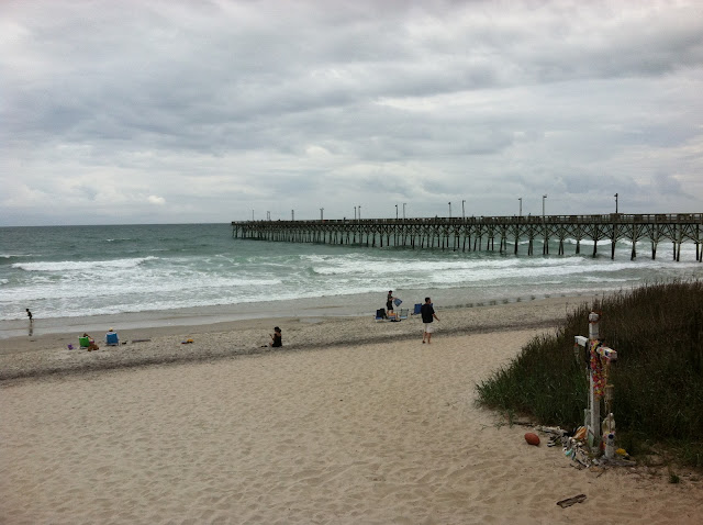
 As we approached Wrightsville Beach we received a call on Ch. 16. “Glory Days, this is USCG small boat. When was the last time you were boarded?”   Ans. “It’s been over a year.” USCG “Slow down and we will pull alongside and board you, do you have any weapons?” Actually it was pretty painless. The Coasties performed a Vessel Safety Check (VSC) which we passed, asked us a few questions, and departed without costing us any time. They were very courteous and professional, and doing their job, and they even called the Wrightsville Beach Bridge and had it open for us ahead of schedule . As it turned out that was unnecessary as we had enough clearance. Just past mm 265, as we entered Stump Sound, I happened to look back to see Something Special being violently rocked by the 75’ motor yacht, Moon Shine, passing him.   I immediately called on Ch. 16 to the vessel and yelled at him to slow down and give me a slow pass. I asked him what his hurry was as we would have to wait 15 minutes for the bridge to open. His response was he wanted to go thru the bridge first so he didn’t have to pass us on the other side. I politely suggested that he learn a little courtesy and that this didn’t make any sense as he could just as easily have waited until we got to the bridge and asked to go ahead, which is common practice. What I learned from another boater during this event is to call a securite’ on Ch. 16 warning other vessels of a “dangerous boater, by name.” This will not only warn other boaters but will be recorded by the USCG and hopefully embarrass the errant Captain into changing his behavior. We got thru the bridge as scheduled at 1:00 and entered the Beach House Marina at 1:10. Surf City is a small beach town bordered by the AICW on the west, and the ocean on the east. It is only a 5 minute walk from one side to the other. It has a very long pier into the ocean for which the town charges admission, not only per person, but for each fishing pole. Welcome to Surf City.
THE FISHING PIER AT SURF CITY, NC

FELLOW LOOPERS EVELYN & SID TILSTRA
 

MOTHER'S DAY IN SOUTHPORT, NC

DAY300; MAY13, 2012
DEP. MYRTLE BEACH 07:26   ARR. SOUTHPORT NC 01:24
D. 47.4sm / 4696.7
We left Myrtle Beach early so we could make a fuel stop at Cricket Cove marina about 10 miles further north. They had the best price in the area, and when you buy 150 gal. of fuel and pay 0.25 less per gal is saves close to $40. Soon after, at mm 355 we entered what is known as “The Rockpile”. This is a narrow channel with very rocky shores on both sides. It extends for about 8 miles, and can be dangerous if you meet a tow (barge) head on. Someone has to move, and it won’t be him. To avoid that situation we have to make a securite’ call before entering “The Rockpile.”. Fortunately, we had no problems. Our original destination was one of the free docks at one of three restaurants that fellow Looper Robert Creech told us about, but we were concerned about being in a safe place with the pending t-storms, so we proceeded on to Deep Port Marina on the Cape Fear River. This turned out to be a really nice marina with the most friendly people and staff. It is part of a complex which includes a ferry port for service to nearby Bald Head Island. The manager, Rob Gandy, even loaned us his personal pickup truck to get groceries and go to a restaurant.

MOTHER'S DAY DINNER AT THE YACHT BASIN EATERY


MYRTLE BEACH, NC

DAY 299; MAY 12, 2012
DEP. GEORGETOWN 06:35  ARR. BAREFOOT LANDING MARINA MYRTLE BEACH, NC 1:18
D. 54.8sm / 4649.3
We departed Georgetown and resumed our journey up the Waccamaw River, and through many abandoned rice fields. Remember Carolina Rice? This is where it came from. As we go further north the scenery gradually changes from marshland to sparsely treed land to densely treed land. We are beginning to see more houses and more development. As we approach Myrtle Beach, the houses become bigger; more elaborate, and more densely developed. As we approach the marina there are shopping centers and condos. The Marina, Barefoot Landing is the shore side of an outdoor shopping center that hosts over 400 stores. Not much else to report here.
THIS WAS AT A STORE CALLED AMERICAN CLASSICS

MURAL IN A RESTAURANT

GLORY DAYS AT BAREFOOT LANDING MARINA

Sunday, May 20, 2012

LOOPER REUNION

DAY 297; THURS. MAY 10, 2012
DEP. CHARLESTOWN 07:30 ARR. GEORGETOWN 2:19
D. 63.5sm / 4594.5
Most of this 63+ mile trip was in sight of the ocean. The ICW runs parallel to the ocean about ¼ mile west. We passed by several inlets, cruised thru Cat Island, into Wynah Bay and into the Waccamaw River. The scenery was very interesting salt marsh, and we were the object of attraction for hundreds of greenheads, horseflies. By the time we docked the deck was littered with the victims of Pat’s flyswatter. We stayed at Hazzard Marina which is one of 3 marinas that border the town. Georgetown has developed the waterfront so that the stores and restaurants along the river face the main street of the town and also have entrances on the boardwalk. It was a really nice town that appeared to be doing well. The highlight of the day was meeting old friends and fellow (now Gold) Loopers Christine & Larry Hayden. We travelled with them on several occasions on the Loop and when not travelling together stayed in touch by phone. They just completed their Loop just yesterday near Charleston, and came up to Georgetown to celebrate with us. We opened the bubbly before noon, had a really good reunion, and went to lunch at the River Walk Restaurant.

HMS BOUNTY AT CHARLESTOWN (MINUS BRANDO)

NOW THAT I HAVE YOUR ATTENTION, WATCH YOUR WAKE!

HERE'S WHERE HERDS OF WILD HORSEFLIES BREED


GOLD LOOPERS CHRISTINE & LARRY

Wednesday, May 16, 2012

CHARLESTON & FT SUMPTER

DAY 295, 296, TUES, WED, MAY 8,9, 2012
AT CHARLESTON
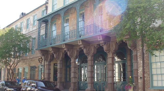
The Charleston Maritime Center was recommended by several cruisers as being good, and close to downtown Charleston.  Right on both counts.  We teamed up with Evelyn & Sid and did the Fort Sumpter Tour on Tues, morning, the Charleston Walking Tour in the afternoon, and dinner at the Noisy Oyster in the evening. On Wed morning the ladies went shopping and in the afternoon then Pat & I went for a walk and to pick up some groceries and got caught in a downpour.  That night we took a cab to Sticky Fingers for some good southern BBQ.


THAT'S HMS BOUNTY BEHIND GLORY DAYS

CARNIVAL CRUISE LINES IN CHARLESTON

FORT SUMPTER AS IT LOOKED WHEN BUILT


FT SUMPTER TODAY


CHARLESTON ON THE HORIZON


RAINBOW HOUSES