GLORY DAYS

GLORY DAYS
2004 Mainship 400 Trawler

Wednesday, August 17, 2011

BEAUTIFUL MACKINAC ISLAND


DAY 71 SAT AUG. 12, DAY 72 SUN. AUG. 13, DAY 73 MON. AUG.15, 2011
DEP. DRUMMOND I. 09:15  ARR. MACKINAC I. 2:30
AM RAIN, NOON RAIN, PM RAIN.  SUN/MON. SUNNY COOL DRY NIGHTS REALLY COOL (50’S)
D. 47.3 SM/1284.9
We were scheduled to depart Drummond I. at 07:00, but it started to rain and we decided to wait another day. Five other boats left between 7am and 8am so we called them and they reported that conditions were not bad, just showers.   We left at 09:15 with Dockers Inn and Dovekie.   Aside from the rain, it was an easy trip. Seas were calm wind was light, visibility was good, but not great. We spotted what we thought was an uncharted island in De Tour Passage, but determined it was moving east at 13 knots and with the aid of AIS decided it must be a ship. This is our first of many ship sightings as we are headed into the Straits of Mackinac (pronounced MackinAW). If you read the guides about Mack. I. they all tell you it is impossible to get a slip on the Island, and if you do, you need to fender up as the many ferries that arrive there (sometimes you can see 4 arriving at a time) have no regard for their wakes. This is all not true. We called ahead and got a slip with no problem. In fact, there were many slips available Sat. due to the rain. As to the ferries rocking us, we did get some small wake action, but not enough to spill the coffee. And, at night there was no wake action at all. The interesting thing about this Island is that there are no cars. All transportation is done with either bikes or horse drawn buggies and wagons. The shuttles for the hotels are horse drawn carriages, all deliveries were made with horse drawn wagons. They all have automobile tires, and the roads are paved, so the ride is smooth. The paving also make it easier for the DPW (Dept. of Poop Works) to remove the used oats that inevitably are dropped by the horses. Although I never heard the term here (no one speaks about it) we used to affectionately refer to these as Road Apples. In any case, the Island is absolutely beautiful. Reminds us of Edgartown, only bigger and more elegant, and, a lot more manure. The Grand Hotel is so grand, they charge $10 per person just to walk on the front porch.   For only $40 p.p. you can have their buffet lunch and, walk on the front porch.   What the hell, you only live once, so we spring for the lunch.   We also visited Ft. Mackinac. I don't usually enjoy these things, but as I said, you only live once.   The Fort was a really good take, but the view from the Ft. was outstanding (which is why they built the fort there). We enjoyed the island so much, we spent three days here. Total marina bill, $159. (for all 3 days). Total experience, priceless! I’ll let the pictures speak for themselves.


THE FABULOUS GRAND HOTEL

FLOWERS GRACE THE WHOLE TOWN

FLOWERS EVERYWHERE!

THE FRONT PORCH OF THE GRAND HOTEL

NICE OLD CHRIS CRAFT

VIEW OF THE CITY MARINA FROM FORT MACKINAC

ANOTHER PANORAMIC VIEW


MARCHING DRILL INSIDE FORT MACKINAC


BACK IN THE USA


DAY 71 FRI. AUG. 12, 2011
DEP BLIND H. 07:OO  ARR. DRUMMOND I. 12:30
CLEAR, CALM COOL AM.  W. WSW 5K.
D. 44.4/1237.6

Finally back in the US. Filled Glory Days with 147 GAL. of fuel (NOT liters) and pumped out holding tank. There is NO town here, just a marina and customs check in. They actually send armed agents to check us in. We arrived as a group of 3 boats, followed by 2 more groups of 3 Loopers, and the agents checked every one of us. You would think they could be better utilized somewhere else stopping illegal aliens, but apparently our Gov’t. in all its wisdom thinks it more important to search sensior citizens. Worse yet, there IS NO WIFI!!!!! There is also no cell phone signal, what kind of country is this???? BTW, Glory Days has been averaging about 3 statute miles per gallon burning about 3 gal. per hour.

FISHING OFF DRUMMOND ISLAND USA
 

We awake from "THE NIGHTMARE in Beardrop Harbor"


DAY 70 THURS AUG 11, 2011
DEP BEARDROP H. 07:10  ARR BLIND H. 09:30
D. 17.3/1193.2
CLEAR SUNNY, WARM
The trip from Beardrop was uneventful.  Seas calm, mostly open water.  The scenery is changing again.  More open water, fewer harbors and islands.  This is our last stop in CA.  Hopefully we will get wifi soon.  The marina is very nice, one of the nicest we have stayed in, but the wifi is down.  The town is not much which surprises us since the marina is so nice.  In fact, I would say the marina is the newest, nicest building in the whole town.


Saturday, August 13, 2011

WHEN A DREAM BECOMES A NIGHTMARE


DAY 67 TUES AUG.9, 2011
DEP. BENJAMIN I. 07:50  ARR. BEARDROP HARBOR 11;45
COOL, CLEAR, CALM  FORECAST  NOON W. 20K SW, NIGHT W. NW 20KD. 22.4sm/1175.8
We left a beautiful anchorage on a cool cloudy day for Beardrop Harbor, just another stop along the way west towards the end of the North Channel.  The forecast when we left was for winds out of the west at 15 to 20 mph.  Beardrop would offer good holding and protection.  NOT!  The forecast kept getting worse, then a high wind warning was issued, but we were anchored already and all was well.

ENTERING BEAR DROP HARBOR


DAY 68 WED. AUG.11, 2011
AT BEARDROP H.  THE DAY IN HELL.
I’d like to say today started like every other day, but it didn’t.  We awoke at 05:30 to a thump and rushed out of bed to find Dockers Inn’s bow in our cockpit.  Our anchor had dragged during the night 50 yards right into Dockers Inn.  Fortunately, she was there or we would have wound up on the rocks in another 15 minutes with considerable damage.  Thank goodness neither boat had any damage, and Dockers’ anchor didn’t come loose.  We immediately started the engine and with the help of Sharon and Ken shoved off and reset the anchor further away.  This was just the beginning of what became a real nightmare day.  The forecast called for 25k wind out of the SW with gusts to 40K diminishing in the late evening.  The anchor was holding, but we were about 100’ from a lee shore strewn with boulders, so anxiety was the emotion for the day.  Around noon I broke out the Guardian danforth anchor and took it out with the dinghy about 200’ to set it.  This gave us some comfort, but around 3:30 the wind started gusting to 40K and the Delta broke loose.  We were now some 50’ from the lee shore, in 10’ of water, but by some miracle the danforth was holding us even though we were swinging wildly.  We got our bearings and monitored our position by the GPS every minute until around 5:30, when a really strong gust of wind broke us free. Fortunately I had the engine running.
Pat and I rehearsed what to do in this event and Pat was able to get the anchor aboard as we circled looking for another spot with more swing room to reset the anchor.  The wind became so strong that Dockers Inn dragged her anchor, as did several sailboats.  We tried several times to reset the Delta anchor without success.  Finally, around 7:00 the Delta set and held with the wind still around 25K.  With Pats help we got the Danforth into the dinghy and dropped it about 15 degrees away from the delta.  Sometime around 8:00 the wind died down to around 15K so we had a quick supper of Ramen noodles and set up an anchor watch.  We have made plans as to where to run the boat aground should we break loose during the night, and packed up our valuables to take with us if necessary.  I slept for 2 hours while Pat stood watch.  It is now 11:15, Pat is sleeping and I am watching.  All is good so far and should continue to be so if the wind doesn’t pick up.  Sorry, no pictures.    


BEAUTIFUL ANCHORAGE


MON.DAY 67 AUG. 8, 2011
DEP. KAGAWONG, ONT 08:50  ARR. BENJAMIN Is. 11:50
COOL, CLEAR, SUNNY, AM W.NE 5K PM W. SW5K
D. 19.0sm/1153.4
We arrived at an anchorage between North and South Benjamin Is. and found 3 other boats there, and 2 of them were Loopers.  By 5:00  we had about 25 boats there, 9 of which were Loopers.  What a beautiful anchorage!  Check out the pics, but they cannot do it justice.  We are surrounded by house sized, somewhat flat granite boulders rising some 100 feet nearby.  They are sparsely covered with trees, and among other plants, blueberry bushes.  The view from the top is just spectacular!  


BENJAMIN I. ANCHORAGE

SMOOTH GRANITE COMPRISES MOST OF THESE ISLANDS

GLORY DAYS FROM HIGH ON THE ROCK

LUMBERJACK JOE

BETWEEN NORTH AND SOUTH BENJAMIN IS. 

LOOPER DINGHYS

DINGHY LOOPERS


ANNIVERSARY #46


DAY 66 AUG. 7, 2011 HAPPY ANNIVERSERY
DEP. 09:10 LITTLE CURRENT, ONT. ARR.  KAGAWONG, ONT. 11:45
AM RAIN, PM CLEARING, W. NE 10 TO 15
D. 16.3 SM/1134.4
Today is our 46th Anniversary.  To celebrate we are going to Bridal Falls in Kagawong, Ont.  Just as we finishing pumping out the holding tank in Little Current, and depart the dock, it starts to rain.  The forecast was for possible showers, now it is a certainty.  For the first hour they are just sprinkles, but they shortly turn into steady heavy rain.  The visibility is not too bad, but we slow down to wait out the rain so we don’t have to pull into the marina in a heavy downpour.  It works, and by the time we pull in the rain has almost stopped.  Like the village that owns it, Kagawong Marina is small.  As I walk up the ramp from the boat I notice what appears to be a bout 3 lbs. of something that resembles ground meat.  Obviously I’m curious and ask the dock attendant what it is.  Oh, that’s just mink sh…  WHAT???  Mink poop!!  "There are some Minks that live under the docks and they leave a pile of this stuff every day."  I hose it off because I don’t want to step in it, then regret I didn’t take any pictures because who would believe it.  Unfortunately, the next morning the mink must have used another dock because I didn’t find any for my picture.  After lunch we take a hike thru the woods to see Bridal Falls.  Not spectacular, but very pretty.  The falls are the main attraction but unfortunately they are not in full flow in the summer.  The other attraction is the local church.  The story behind the boat bow pulpit is tragic.  A family perished when the boat capsized in bad weather and the bow was used as a memorial in the church.  So much for Kagawong!  Happy Anniversery! 


UNDER THE FALLS

ILLEGAL LOBSTER???  (CRAWFISH)

PAT AT BRIDAL FALLS


BOAT BOW PULPIT IN LOCAL CHURCH

THE BEGINNING OF THE NORTH CHANNEL


Day 65 SAT AUG. 6, 2011
CLOUDY, BREEZY T-STORMS FORECAST
DEP. BAE FINE 10:45 ARR. LITTLE CURRENT, ONT 2:00
D.25.0sm/1118.1
Little Current is an interesting little village at the beginning of the North Channel.  The village has sunk a ton of money into the marina with new floating docks, new power stations, bathrooms, showers, etc.  All very nice.  It is mostly a summer destination for tourists, but I didn’t see any hotels or motels, so I guess it’s just for boaters or day trippers.  Nice marina, but I couldn't get any pictures of the town.  Every mornong at 9:00 Roy hosts a cruiser's net from here.  On channel 71, he reads the weather and news then boaters in the area call in to report where they are and where they are going that day.  It's neat in that it allows you to keep tract of people you have met.

LEAVING KILARNEY

THE SPORTSMANS INN MARINA, KILARNEY

THE LOW BRIDGE INTO LITTLE CURRENT

THE LIGHT HOUSE AT LITTLE CURRENT

THE BRIDGE CLEARANCE
 

THE POOL IN BAE FINE


THE LONGEST DAY
DAY 63 THURS. AUG 4, 2011
WRIGHT’S MARINA TO KILLARNEY (SPORTMEN’S INN)
AM, CLEAR, COOL SUNNY, PM SUNNY COOL WIND <5k L57/H76
D. 65.22SM/1185.2

I just noticed that Tues we broke the 1,000 mi. mark.  Hooray, only 5,000 more to go.  The original plan was to anchor out at the Busterd Is. yesterday, but due to the weather we stayed in port.  What a good decision that was.  Not that anchoring out in rain is bad, but with yesterdays wind we would never have been able to navigate safely through some of the channels we went thru this AM.  Soon after we departed we encountered the Cunningham Channel, and shortly thereafter Rogers Gut.  Both of these channel required very tight maneuvering, through narrow spaces between boulders, sometimes no more than 20’ wide, and sharp turns, sometimes 120 degrees.  If that isn’t bad enough, don’t look down!  The water is crystal clear and you may have 10’ under your keel, but the rocks look like inches deep.  You really have to focus on what you are doing, and then later go change your shorts.  The scenery gets even more spectacular than before.  The islands are getting taller, the cottages fewer and further between and the temps. lower.  After these challenges things get easier.  For the next 20 miles we are offshore in much deeper and open water.  Here we can set the autohelm and take a break from intense hand steering.  What a relief, but 2 hours later we are back into Collins Inlet where we remain for the next 20 miles.  This is characterized by even taller steeper banks and shallower muddy bottoms.  In one narrow spot we show 3.7’ under the boat.  After 2 hours of this we are down to the last 5 mi, mostly across open water into Killarney Harbor.  Seven and one half hours and 65.22 miles in what so far is our longest day. 
Tonight its dinner out with friends, and tomorrow we lay over a day to rest and plan the next week when we go through the NORTH CHANNEL of Lake Huron after which we will finally reenter the good old US.


CUNNINGHAM CHANNEL
COLLINS INLET
COLLINS INLET

BEAUTY IS IN THE EYE OF THE BEHOLDER
AWESOME SCENERY
 
KILLARNEY, ONT. CA

WORK ON THE BAY


DAY 64 FRI. AUG.5, 2011
KILLARNEY TO BAE FINE  “THE POOL”
WARM SUNNY DAY
DEP KILLARNEY 11:00  ARR. THE POOL 2:30
D. 26.4 sm/1093.1
So much for a day to rest.  Weather is beautiful, but the forecast for the next day is not so good, so we decide to depart for “The Pool.”  It’s about a 10 sm run to Bae Fine, and about another 9 sm to the pool.  The Bae is a narrow fijord like body of water about one quarter mi wide at the entrance and 40’ wide at the end, surrounded by tall granite cliffs, ending up in a pool that is about 300 yards in diameter surrounded by high granite walls mostly covered with trees.  One of the pictures shows Francis Langford's and husband Ralph Evinrude's Bae Fine house.  They used to cruise their 100' yacht CHANTICLEER to here from Stuart, FL.
KEN, SHARON & PAT IN BAE FINE

 FRANCIS LANGFORD'S HOUSE

BAE FINE TURTLE RACES

EARLY MORNING MIST

GLORY DAYS AT ANCHOR
GRANITE WALLS ENTERING BAE FINE

Wednesday, August 3, 2011

OUT OF THE SMALL CRAFT CHANNEL ONTO THE BAY


BETTER BE IN THE CHANNEL
DAY 61 TUES. AUG. 2, 2011
AM CLEAR, SUNNY WIND > 5K L60/H75 PM CLOUDY W 15-20K
DEP, KILBEAR 07:50 ARR. WRIGHT’S MARINA, BYNG INLET 1:30
D. 51sm/1007
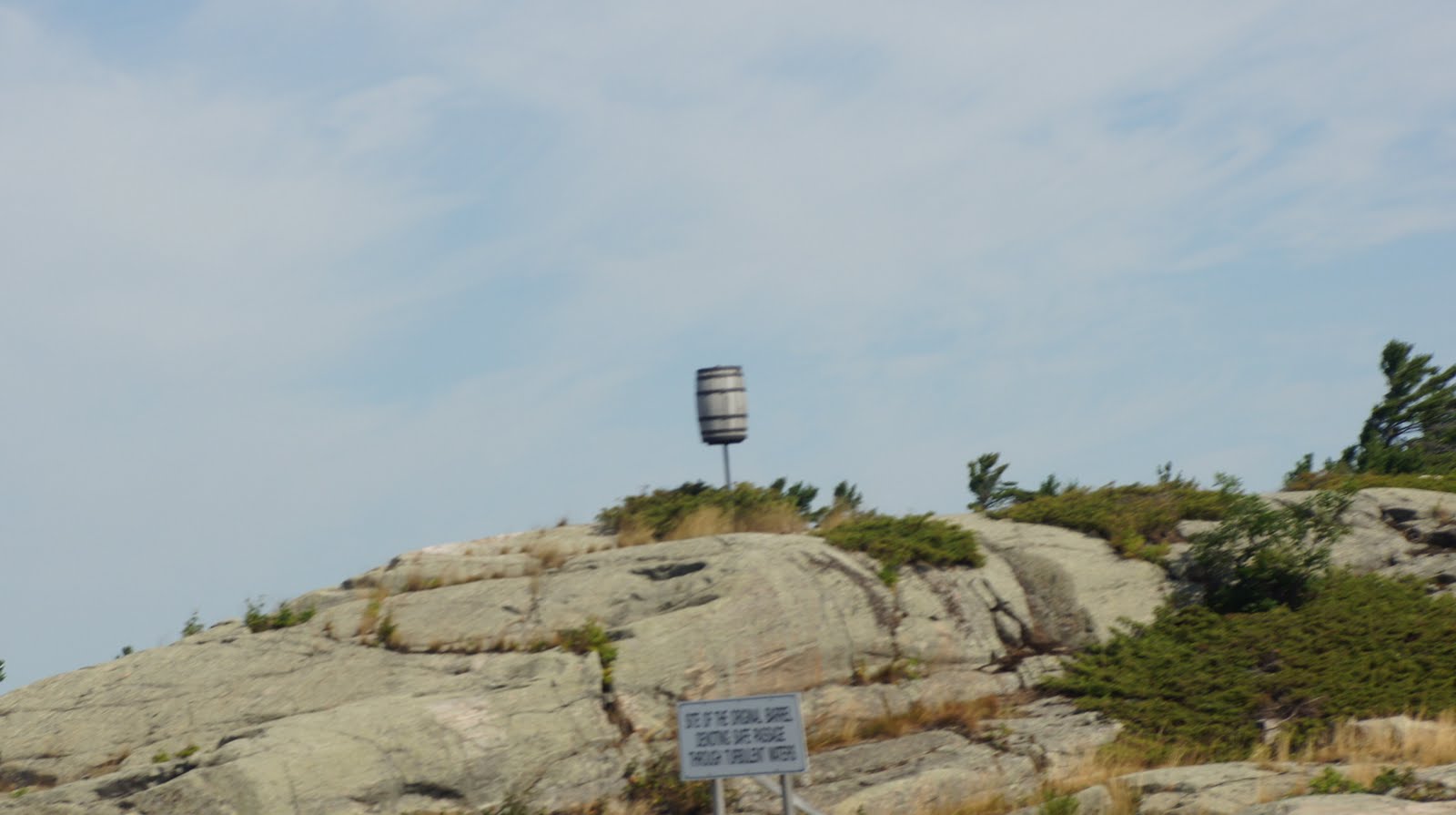
We left Kilbear Marina early so we could cruise 53 m to the Busterd Islands and spend the afternoon and night at anchor. In order to avoid 2 very narrow passages, Canoe Channel and Hangdog Channel we decided to leave the small craft channel for the open waters of Georgian Bay. We left through Pointe au Baril, which is French for Barrel Point. The point is named for the single barrel that was posted to a rock to mark the safe passage into the channel from Georgian Bay. The wind offshore was very light, which it must be for small craft or you could be in for some nasty waves especially with a west wind. The waves we had were all less than a foot and the trip from Pointe au Baril to Byng Inlet was uneventful and relaxing. In fact we set the auto helm for the Byng Inlet buoy about 12 miles north and each took a 20 min. nap while taking turns at the helm. I heard some other boaters on the marine radio chatting about an upcoming storm, so we got an updated forecast, and sure enough, there were T-storms forecast for the night. Not my favorite kind of weather for anchoring. We called Docker’s Inn and decided to seek out a secure marina for the night, so here we are in Wright’s Marina anticipating some nasty weather. At 5:30 we got together with Ken & Sharon (Docker’s Inn), Carol & Rich (Salt N Sand), the 2 boats we travelled here with, and John & Gloria (Bombay Lady), and Shelly & Mark (Rock Chalk) for Happy Hour. Speaking of Happy Hour, Carole & Rich, from Cape May, NJ brought as their contribution about 1 lb. of Blue Crab fingers. These are the large claws with theshell removed from the teeth back, so all you have to do is grab the toothy end, dip into some sauce, and eat. What a special treat!
LOCAL WORK BOAT

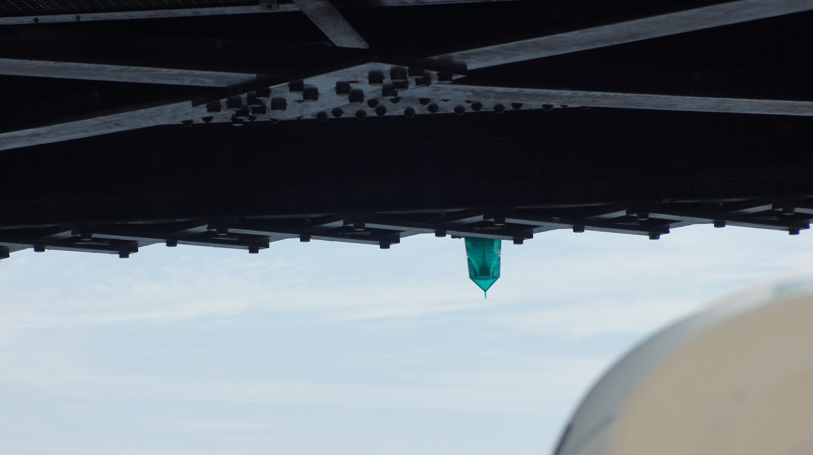
POINTE AU BARIL LIGHT

THE ORIGINAL BARREL


ENTERING BYNG INLET

A COZY COTTAGE

FROM ORR TO SCHNITZEL

DAY 61  MON AUG. 1. 2011
CLEAR, SUNNY, WIND 5 -10K WEST
DEP. PARRY SOUND 09:00   ARR. KILBEAR 11:00
D. 12sm/966
The plan for today was to go from Parry S. to Kilcarsie Bay and anchor out for the day, then proceed to Kilbear Marina for the night. When we arrived at Kilcarsie Bay we found that the place is really popular for vacationing Canadian boaters, and there was no room to anchor. Also, the water temp was only about 72*, which to us Americans is a wee bit too cold to swim. (Yes, I’m a wuss. Since I’ve lost all this weight I can’t stand to be cold.) One of the main reasons we wanted to stop at Kilbear is that there is a restaurant there that is supposed to have excellent German food. We were looking forward to the Schnitzel, but unfortunately it was a disappointment. First, there was only one German beer there and it was in a can. Second, the schnitzel turned out to be a breaded pork cutlet deep fried and served with a little mushroom gravy. We did have spaetzel and red cabbage , but none of it tasted authentic or home made.
ANCHORAGE AT KILCARSIE BAT

AROUND THE CORNER TO KILBEAR
 

PARRY SOUND AND BOBBY ORR

   
DOCKER'S INN ENTERING ONE OF MANY NARROW PASSAGES
DAY 59, SAT, JULY 30, 2011
L62/H75 CLEAR CALM.
DEP. PORT RAUSON 08:45ARR. PARRY SOUND 12:00
D. 23sm.953.2
From Port Rauson we had to retrace our route back to Henry’s and from there take the main channel to the South Channel route to Parry Sound, our next port of call where we plan to spend 2 nights.The S. Channel is beautiful with more of the same rugged shores, isolated cottages, narrow passages between boulders, and challenging boat handling demanding very close attention.Throw in a bunch of locals in runabouts, dinghies, and jet skis zooming in and out and it adds to the fun. Notice the shot of the swing bridge at the entrance to Parry Harbor. The bridge tender said we didn't need to have him open the bridge as we could make through. He was right, but it did make for some tense moments. After we tie up, get settled and have lunch, we walk the short distance to the Bobby Orr Hall of Fame with our friends Jean & Brian Orr. Brian looks up some genealogy on the web, and indeed finds that some of his forebears are from the same area as Bobby Orrs.Nothing definite, but the real possibility of a family connection.The Hall was a great take with videos , pictures, trophies, and of course, gifts.
SPECTACULAR SCENERY, BUT ROCKS IN THE WATER ARE NOT PRETTY!

SWING BR. ENTERING PARRY S. NOTE BRIDGE TENDER ON R.CHECKING CLEARANCE

PAT & JOE AT BOBBY ORR HALL OF FAME

THE FAMOUS SHOT OF THE WINNING O.T. GOAL

THIS SAYS IT ALL